Nigeria is aiming to earn around 12 billion dollars each year by helping international shipping companies with chart checking, distribution, and revenue collection. This is part of Nigeria’s plan to join the global market for Electronic Navigational Charts, which is worth about 90 billion dollars.
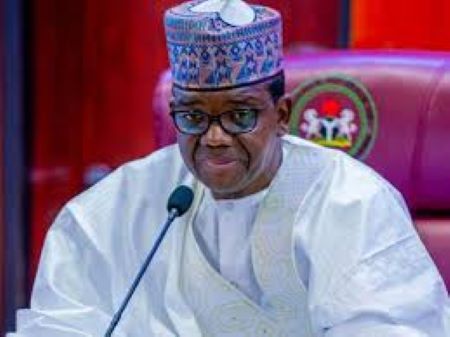
The Minister of State for Defence, Bello Matawalle, said this during the World Hydrography Day 2025 and the West African Hydrographic Summit held on Saturday in Abuja. The theme of the event was “Seabed Mapping – Enabling Ocean Action.”
He explained that the Nigerian government has set up a special center called the International Centre for Electronic Navigational Charts. This center will also serve as a regional office and training hub for West Africa.
He promised that Nigeria would support training in hydrography (the science of mapping water bodies), invest in new technologies, and strengthen relationships with other countries. The goal is to make sure all Nigerian waters are safely and properly mapped.
He also said that the sustainable growth of communities near rivers and the coast depends on how well the country understands and manages its ocean and water resources.
He formally announced the creation of the International Centre for Electronic Navigational Charts in Abuja. This center will be managed by Nigeria’s National Hydrographic Agency.
By opening this center, Nigeria now joins four other countries— the US, UK, Australia, and Brazil— that already have such regional offices.
This step will allow Nigeria to benefit from the global Electronic Navigational Chart market, possibly making between 9 to 12 million dollars a year by offering services to international shipping companies.
The minister said that mapping the seabed is not just a technical task anymore—it’s now essential for connecting digital cables, transporting fuel, and protecting marine life.
He added that even though seabed mapping is very important for modern life, much of the ocean floor remains unmapped and unprotected.
The information that hydrographers collect under water helps with safe shipping, planning sea use, studying climate change, protecting the coast, and growing the ocean-based economy.
He praised the National Hydrographic Agency for its achievements since it was founded in 2021.
He explained that seabed mapping is the starting point for any effective action in the ocean. It is essential for smart decisions and progress.
He said Nigeria has made great progress in being recognized as a reliable country in hydrography and is working to promote it across West Africa.
Matawalle said the event was more than just about seabed mapping. It was also about creating useful tools, collecting data, and building partnerships to help protect the ocean, improve navigation, and manage marine resources better.
He said seabed mapping is key to unlocking opportunities in the blue economy, which can help Nigeria grow its economy, create jobs, improve food supply, and boost energy production.
From mapping areas for wind energy to finding safe sea routes and protecting marine environments, hydrography plays a central role in building a strong ocean-based economy.
He urged Nigeria to use its knowledge and abilities in hydrography not only to protect its waters but also to support its economic growth.
He said investing in seabed mapping means investing in Nigeria’s future—its security, development, and future generations.
He ended by promising that the Nigerian government will continue to support hydrographic training, invest in technology, and strengthen cooperation with neighboring countries. The goal is to ensure all Nigerian waters are safe, properly mapped, and well managed.


